
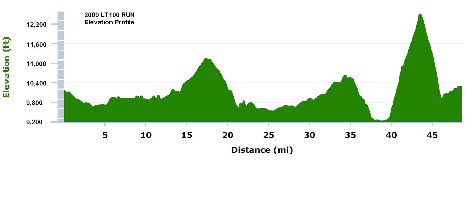
Here are some elevation facts and numbers for the Leadville 100 run course. It's called the "Race Across the Sky" because this 100 miler takes place between 9,200' and 12,500' above sea level, with two climbs over Hope Pass (~3,000' elevation gain and loss each way) and two climbs over Sugarloaf Pass (~1,400' elevation gain and loss each way).
The following diagram is the profile of the first 50 miles. At mile 50, you turn around and do it all over again in reverse.
Let's play with a few more numbers using this fun altitude.org site: http://www.altitude.org/air_pressure.php
At 880' ASL we flatlanders have 97% of the oxygen available at sea level. Take us up to the start/finish line in Leadville, Colorado, at 10,200' ASL and we're down to 70% of the oxygen available at sea level. And atop Hope Pass, we're lose more oxygen at 64%.
In short, it's a fantastically stupid choice for a first 100 miler, and maybe that's what makes it so appealing.
No comments:
Post a Comment